IMAGE PROCESSING
Advanced Image Processing: Image Registration, Geo-Referencing, and Image Mosaic
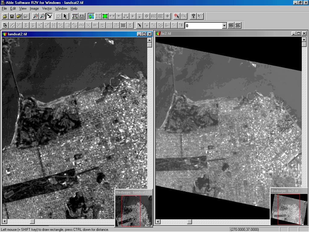
Image Registration and Warp
- R2V allows you to register one image against another image by using 4 or more control points.
- Image warp can correct map or image distortion so that two images can be overlaid on top of each other.
- R2V supports bi-linear or triangulation based methods for image registration.
Geo-Referencing Images with R2V:
- GeoTIFF: supported by many image processing and GIS packages
- World File: supported by all ESRI products and other packages.
- TAB File: supported by MapInfo and other products.
- R2V's own control points method.
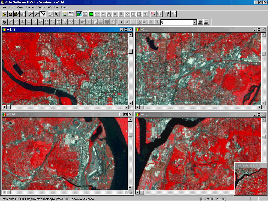
Image Mosaic
- R2V's Image/Mosaic function allows you to stitch a group of images together to create a mosaic image. Images with overlapped borders are correlated to create seamless image mosaic.
- This function can be used to merge small image sections together when using a small format scanner.