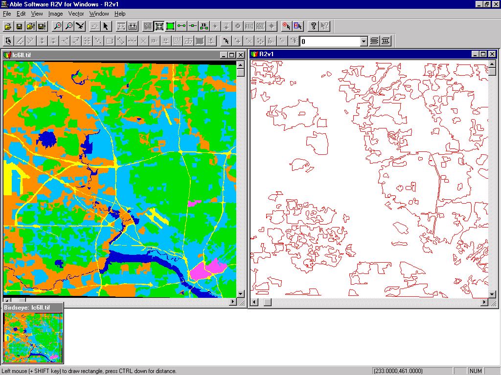
R2V: Advanced Raster to Vector Conversion Software

About R2V    FAQ    Download Demo   Tutorial    User List    Price   Purchase


R2V is currently being used in more than 60 countries by thousands of users for map digitizing, GIS and CAD conversion applications

R2V Applications
Contour Map Digitizing
Parcel/Tax Map Digitizing
Soil Map and Flood Map Digitizing
Mapping from Aerial Photos & Satellite Imagery
Create 3D DEM from Contour Maps
CAD Drawing Conversion
Image Geo-Referencing, Registration & Processing
UTM, Lat/long and State Plane Projection Systems

Download

Download R2V Demo
R2V Output Samples
Image Samples
About R2V
Functions
User List
Frequently Asked Questions
Tutorial
User's Manual 
1-Day Training
Order R2V
Price List 
Order R2V Online
Get Order Form
R2V Resellers and Distributors
Support/Upgrades
Technical Support and Download Upgrades
R2V Release Notes
Register
Company Info
Search
Able Software
email Us
GIS Links

Mapping Using Aerial Photos and Satellite Imagery

Create Maps from Aerial Photos or Satellite Imagery

Aerial photos and satellite imagery provide the rich information source for computer mapping and map creation.
You can use R2V to extract vector boundaries from aerial photos or satellite imagery or trace streets and roads.
If your image is classified, the Vector/Auto Vectorize command can create map layers for all classes with just a single command.
Here is an example of a map created from SPOT imagery
SPOT Image


Update Existing Maps Using Aerial Photos or Satellite Imagery

R2V supports GeoTIFF, World File, and TAB file for image geo-referencing. To update your map, simply open the image and import your vector map layer into R2V.
Use R2V's easy-to-use line editor to update your maps.


Copyright © 1993-2008 Able Software Corp. All rights reserved.