R2V: ADVANCED RASTER TO VECTOR CONVERSION SOFTWARE
R2V is an advanced raster to vector
conversion software for automated map digitizing, GIS data capture and
CAD conversion applications. R2V is currently being used in more than
60 countries by thousands of users for mapping and GIS data conversion
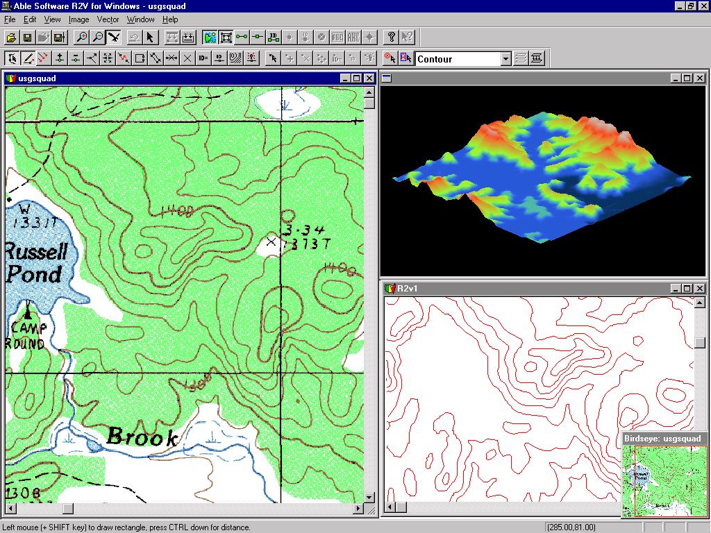
applications. R2V supports fully automatic vectorization and interactive line
tracing from scanned maps and drawings. R2V inputs bi-level, grayscale,
and color images in TIFF, GeoTIFF, GIF, JPEG, RLC, PNG or BMP
formats. It exports vector data to ArcView Shapefiles, Arc/Info
Generate, MapInfo MIF/MID, AutoCAD DXF, IGES, STL, VRML, SVG ( Scalable Vector Graphics)
and MapGuide SDL formats. R2V provides complete on-screen image and vector editing, labeling,
and geo-referencing using GeoTIFF or user specified control points,
image rubber sheeting, color image classification and separation, text
symbol detection and recognition (OCR), automatic polygon layer
creation, 3D DEM and Grid creation, and 3D display and image draping.
R2V is currently being used in more than 60 countries for mapping and
GIS database creation applications.
"Thanks to the batch functions
within R2V, we were able to
complete the task 6.5 weeks ahead of schedule.", Zoltan Szecsei, Cape Town South
Africa
Application Cases Using R2V
- NOAA Coastal Service Center: R2V Is Used for Mapping Benthis Habitat
- Marketing Geological Information Packages
- Contour Modeling Thailand with R2V for Windows
- World Wild Life Fund Chooses R2V for Automated Map Digitizing
- Digitizing Historical Maps
- R2V Automates Mapping for Mine Clearance Mission in Cambodia
- Introduction to Raster, Vector and Automated Digitizing
- Click here to get a list of publications about R2V on GIS World, Earth Observation Magazine, GeoInfo System, CADALYST, Photogrammetry Engineering & Remote Sensing, and more.
 Version Française
This article has been translated to Serbo-Croatian language by Jovana Milutinovich.